| Historical Information | ||||||
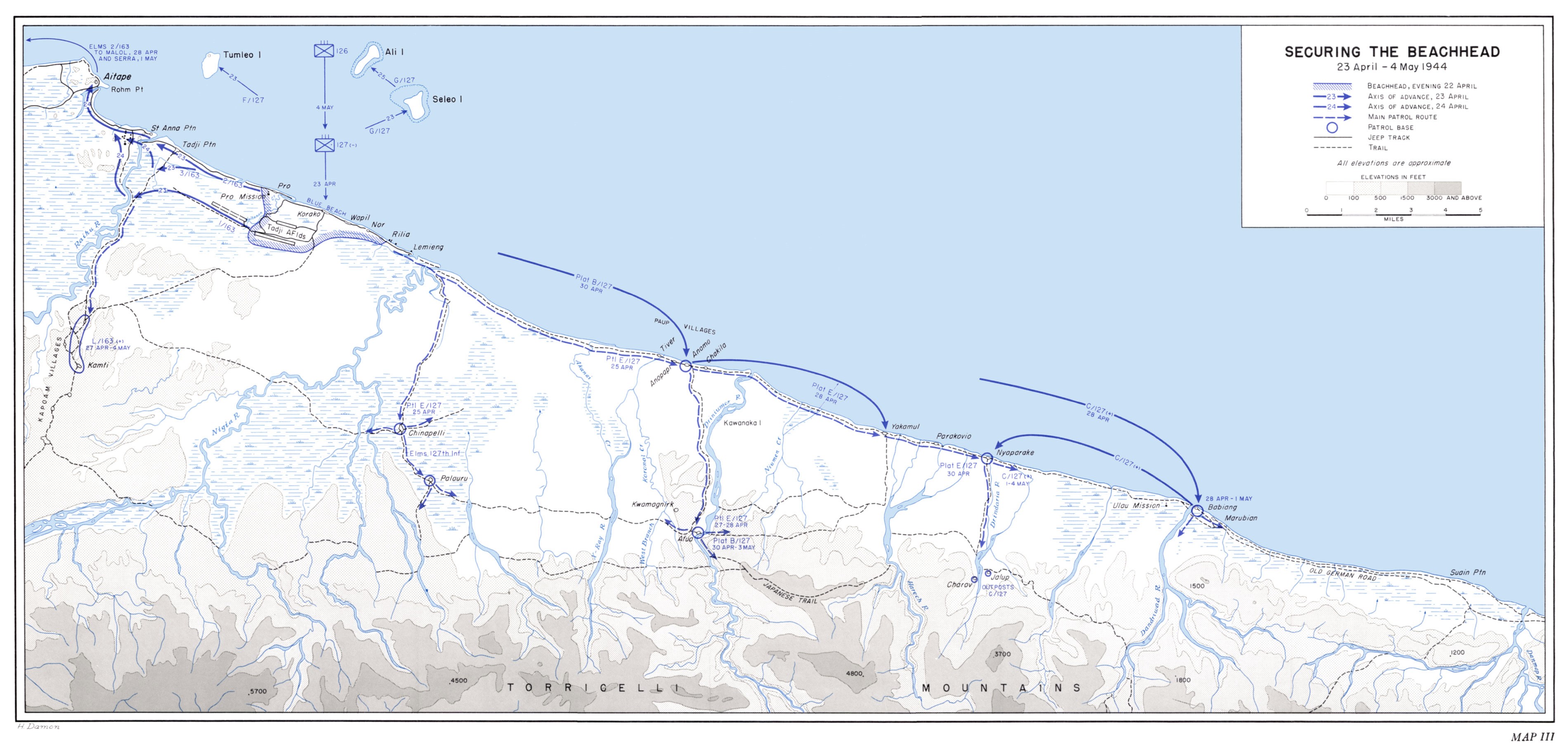
| Caption | United States Army map of the invasion beachhead at Aitape, New Guinea depicting the progress after the landings of 23 Apr 1944. ww2dbase | |||||
| WW2-Era Location Name | Aitape, New Guinea, Australian New Guinea | |||||
| Date | 23 Apr 1944 | |||||
| Photographer | Unknown | |||||
| Source Information | ||||||
| Source | ww2dbaseUnited States Army | |||||
| Related Content | ||||||
| More on... |
| |||||
| Licensing Information | ||||||
| Licensing | Public Domain. According to the United States copyright law (United States Code, Title 17, Chapter 1, Section 105), in part, "[c]opyright protection under this title is not available for any work of the United States Government". Please contact us regarding any inaccuracies with the above information. Thank you. |
|||||
| Metadata | ||||||
| Added By | David Stubblebine | |||||
| Photo Size | 3,800 x 1,818 pixels | |||||
Você gostou deste artigo ou achou este artigo útil? Se sim, considere nos apoiar no Patreon. Mesmo USD $1 por mês já vai longe! Obrigado. Por favor, ajude-nos a espalhar a palavra: Fique atualizado com WW2DB: |
Pesquisar WW2DB

Map
WW2-Era Location Name:Aitape, New Guinea, Australian New Guinea
Latitude-Longitude:
-3.1920, 142.4602
Estatísticas Atuais do Site
- » 1,171 biographies
- » 337 events
- » 44,911 timeline entries
- » 1,245 ships
- » 350 aircraft models
- » 207 vehicle models
- » 376 weapon models
- » 123 historical documents
- » 261 facilities
- » 470 book reviews
- » 28,521 photos
- » 365 maps
Citação Famosa da 2ª GM
"All right, they're on our left, they're on our right, they're in front of us, they're behind us... they can't get away this time."Lt. Gen. Lewis B. "Chesty" Puller, at Guadalcanal
Apoie-nos
Por favor, considere nos apoiar no Patreon. Mesmo R$1 por mês já faz uma grande diferença. Obrigado!
Ou, por favor, nos apoie adquirindo alguns produtos do WW2DB na TeeSpring. Obrigado!