| Historical Information | ||||||
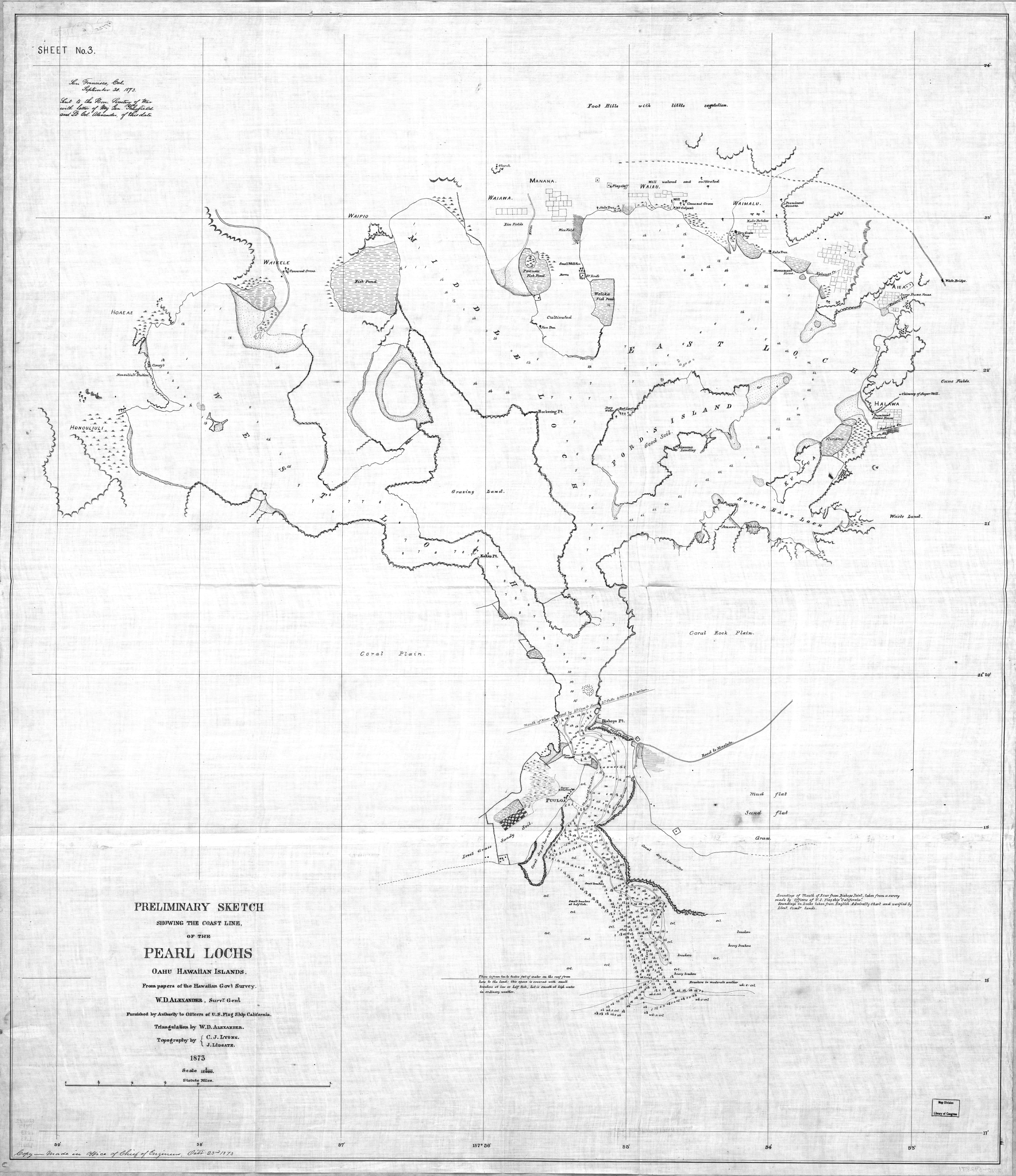
| Caption | 1873 United States Navy map of Pearl Harbor, Hawaii before any harbor improvements had been made. Note that it is labeled Pearl Lochs and the opening is called the mouth of a river. ww2dbase | |||||
| WW2-Era Location Name | Honolulu, Oahu, Hawaii | |||||
| Date | 1873 | |||||
| Photographer | Unknown | |||||
| Source Information | ||||||
| Source | ww2dbaseUnited States Library of Congress | |||||
| Identification Code | 2010592871 | |||||
| Related Content | ||||||
| More on... |
| |||||
| Colorized By WW2DB |
Colorized with Adobe Photoshop |
|||||
| Licensing Information | ||||||
| Licensing | This work is believed to be in the public domain. Please contact us regarding any inaccuracies with the above information. Thank you. |
|||||
| Metadata | ||||||
| Added By | David Stubblebine | |||||
| Photo Size | 6,020 x 6,965 pixels | |||||
Você gostou deste artigo ou achou este artigo útil? Se sim, considere nos apoiar no Patreon. Qualquer valor já vai ajudar! Obrigado. Por favor, ajude-nos a divulgar o site: Fique atualizado com WW2DB: |
Pesquisar WW2DB

Map
WW2-Era Location Name:Honolulu, Oahu, Hawaii
Latitude-Longitude:
21.3679, -157.9771
Estatísticas Atuais do Site
- » 1,178 biografias
- » 337 eventos
- » 45,081 entradas na linha do tempo
- » 1,245 navios
- » 350 modelos de aeronaves
- » 207 modelos de veículos
- » 376 modelos de armas
- » 123 documentos históricos
- » 261 instalações
- » 470 eventos
- » 28,491 fotos
- » 365 mapas
Citação Famosa da 2ª GM
"An appeaser is one who feeds a crocodile, hoping it will eat him last."Winston Churchill
Apoie-nos
Por favor, considere nos apoiar no Patreon. Mesmo R$1 por mês já faz uma grande diferença. Obrigado!
Ou, por favor, nos apoie adquirindo alguns produtos do WW2DB na TeeSpring. Obrigado!